


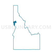
Lewiston 13 Voting District, Nez Perce County, Idaho
About
Outline

Summary
| Unique Area Identifier | 564313 |
| Name | Lewiston 13 Voting District |
| County | Nez Perce County |
| State | Idaho |
| Area (square miles) | 0.83 |
| Land Area (square miles) | 0.83 |
| Water Area (square miles) | 0.00 |
| % of Land Area | 100.00 |
| % of Water Area | 0.00 |
| Latitude of the Internal Point | 46.39311750 |
| Longtitude of the Internal Point | -117.01812650 |
Maps


Graphs
Select a template below for downloading or customizing gragh for Lewiston 13 Voting District, Nez Perce County, Idaho


Neighbors
Neighoring Voting District (by Name) Neighboring Voting District on the Map
- Lewiston 10 Voting District, Nez Perce County, ID
- Lewiston 12 Voting District, Nez Perce County, ID
- Lewiston 14 Voting District, Nez Perce County, ID
- Lewiston 16 Voting District, Nez Perce County, ID
- Lewiston 8 Voting District, Nez Perce County, ID
- Lewiston 9 Voting District, Nez Perce County, ID